
Smartwater

SmartWater provides knowledge of field water flow and accumulation, and actions to mitigate excess field surface water.
A full farm water management plan will help prioritize yield loss risks and implement a cost effective field surface water management strategy.
Manitoba’s #1 crop production limiting factor is excess field surface water.
See our infographic on the cost of surface water:

-
1. COLLECT ELEVATION DATA
Collect elevation data by tractor/vehicle, drone imagery or LiDAR.

-
2. DEVELOP DRAINAGE PLAN
Use field elevations to identify flowcharacteristics (water flow network andaccumulation areas) and determinecut and fill placement.
-
3. MITIGATE EXCESS WATER
Upload surface water flow files into display and use to implement cut and fill placement. Talk to your OptimizePro team for further information on equipment and AMS requirements.
-
1. PRIMARY WATER ANALYSIS
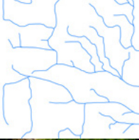
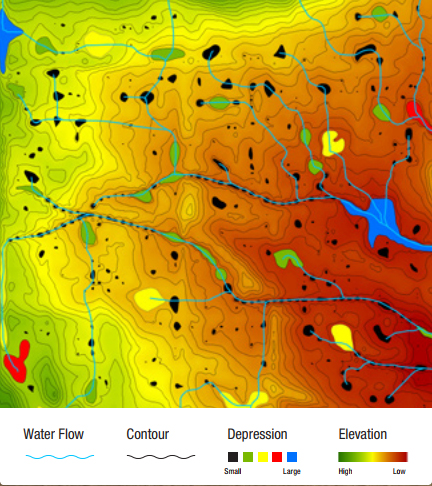
- Paper map indicating the natural and artificial water flow network, areas of accumulation and relief across the entire surveyed field
- Background map for viewing in the display as a quick reference guide*
- Interactive files to view in Google Earth from any smart device
-
2. COMPREHENSIVE WATER ANALYSIS**
Options for additional information following a Primary Water Analysis include:
- Depression risk assessment through calculation of affected acres
- Prioritised depressions to cut or fill from volume measurements
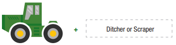
- Ditch recommendation – best fit scenario from layout of depressions, contours and water flow network
- Land shaping analysis and recommendations
- Background map for viewing in the display as a quick reference guide*
-
3. PERMIT SUPPORT
- Technical support available for collecting and completing documentation required for ditch permit application.
* Additional fees may apply for Green Star ready file conversion
** Comprehensive water analysis is completed through consultation and based on an hourly charge.
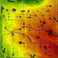
Map Types
Each map provides unique data and analysis for the same portion of land.
-
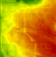
1. ELEVATION
-
2. DEPRESSION

-
3. WATER FLOW NETWORK
-
4. PRIMARY OVERLAY
-
1. PRIMARY WATER ANALYSIS
- JD StarFire 3000 or 6000 RTK Ready Receiver (Tractor)
- JD StarFire 3000 or 6000 RTK Ready Receiver (Implement)
- JD Application Controller 1100
- iGrade Activation
- Greenstar 3 2630 Display
- Autotrac Activation
- Surface Water Pro Plus Activation
- Apex Desktop Software
SmartWater analysis files are compatible with the majority of water management solutions available.
Note – Additional brackets and harnesses specific to the tractor and implement will also be required.
-
- Machine selection for elevation survey collection is critical. Suspension type, little change of characteristics throughout elevation survey collection operation -Â i.e. windrower and track tractor.
- When using wheeled machines ensure tire pressures are checked, adjusted, and consistent.
- Machine and implement input configuration of equipment and GPS offsets are precise and consistent.
- Survey in dry field conditions to prevent ruts – i.e. 4in. rut is equal to 4in. error is elevation survey data.
- Use RTK differential correction sources for the elevation survey operation:
- Best: Absolute Base < 1 mile
- Good: Quick Survey Base < 1 mile
- Fair: Absolute Base > than 1 mile and < 3 miles
- Proper bench marking process must be implemented and maintained when using quick survey base station configurations; repeatability required.
- Surveying while performing an additional field operation: configure survey settings to collect the greatest number of data points possible without affecting primary operation. Preferred pass interval of < 50 ft.
- Collect additional points to increase elevation resolution from field areas of concern.
- Survey existing ditches and surrounding water runs if possible.
- Due to high volume of data, transfer elevation survey data utilizing USB to water management software. Wireless data transfer of elevation survey data from display cannot be completed.
